
Generation of Indoor Open Street Maps for Robot Navigation from CAD Files
Published in arXiv, 2025
You can view this paper on arXiv here.
Demo Video
Abstract
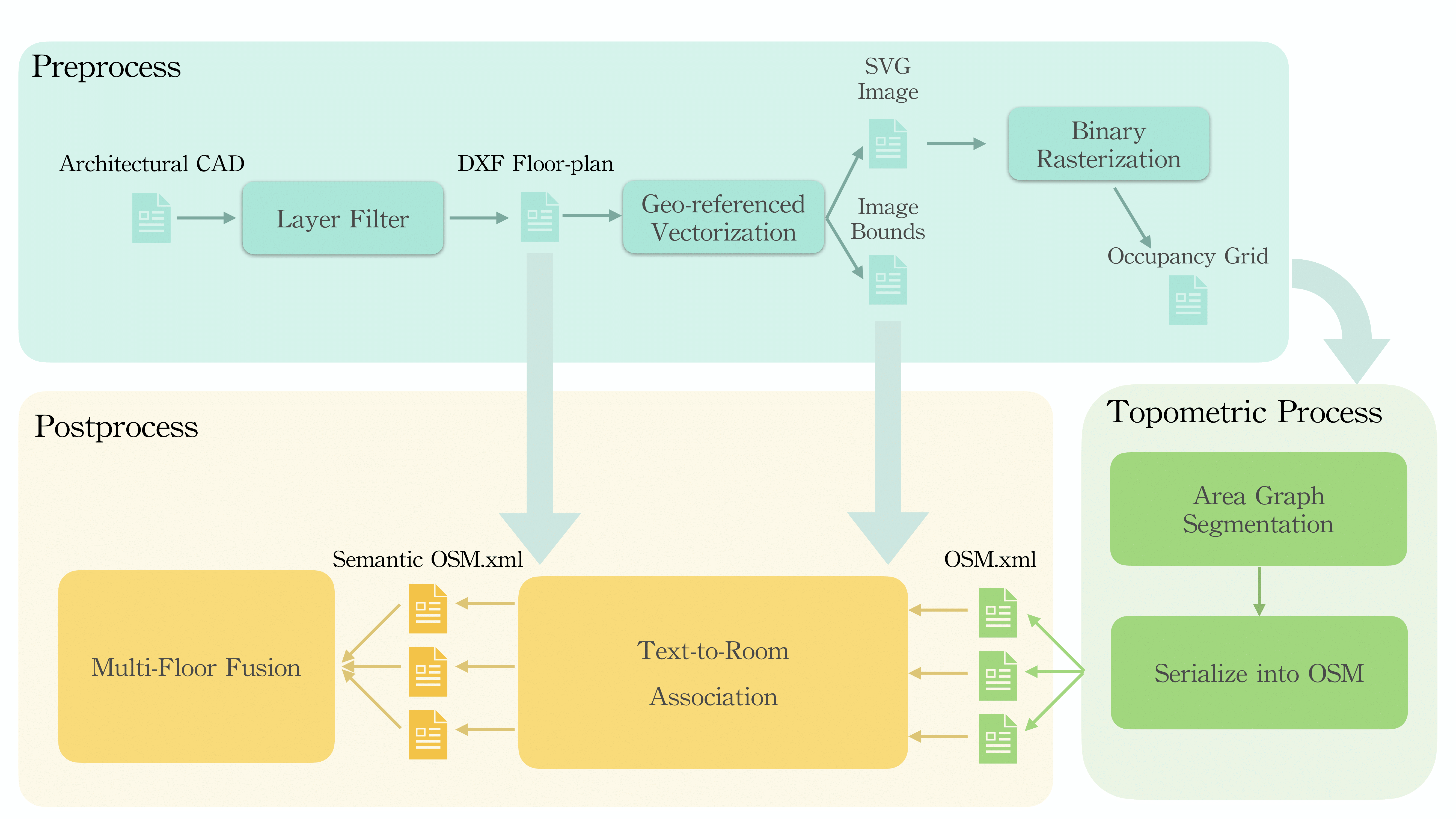
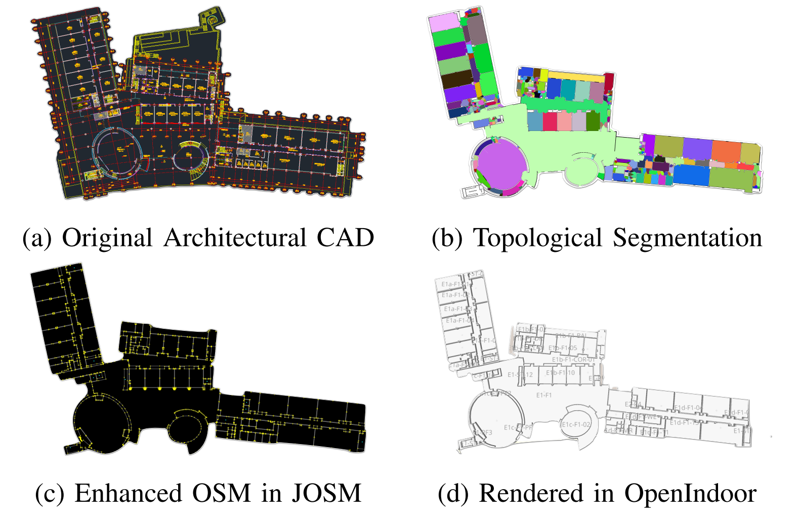
The deployment of autonomous mobile robots is predicated on the availability of environmental maps, yet conventional generation via SLAM (Simultaneous Localization and Mapping) suffers from significant limitations in time, labor, and robustness, particularly in dynamic, large-scale indoor environments where map obsolescence can lead to critical localization failures. To address these challenges, this paper presents a complete and automated system for converting architectural Computer-Aided Design (CAD) files into a hierarchical topometric OpenStreetMap (OSM) representation, tailored for robust life-long robot navigation. Our core methodology involves a multi-stage pipeline that first isolates key structural layers from the raw CAD data and then employs an AreaGraph-based topological segmentation to partition the building layout into a hierarchical graph of navigable spaces. This process yields a comprehensive and semantically rich map, further enhanced by automatically associating textual labels from the CAD source and cohesively merging multiple building floors into a unified, topologically-correct model. By leveraging the permanent structural information inherent in CAD files, our system circumvents the inefficiencies and fragility of SLAM, offering a practical and scalable solution for deploying robots in complex indoor spaces.
Recommended citation: Zhang, J., Wu, S., Ma, X., & Schwertfeger, S. (2025). Generation of Indoor Open Street Maps for Robot Navigation from CAD Files. arXiv preprint arXiv:2507.00552.
Download Paper