SLAM with Vertical Plane Segmentation for Lifelong Indoor Mapping
Development of a SLAM system with vertical plane segmentation for creating long-term indoor maps
Motivation
Indoor environments change frequently, making conventional maps quickly outdated. This project develops a SLAM system that focuses on persistent structures to produce clean, long-lasting maps for dependable lifelong indoor navigation.
Method Overview
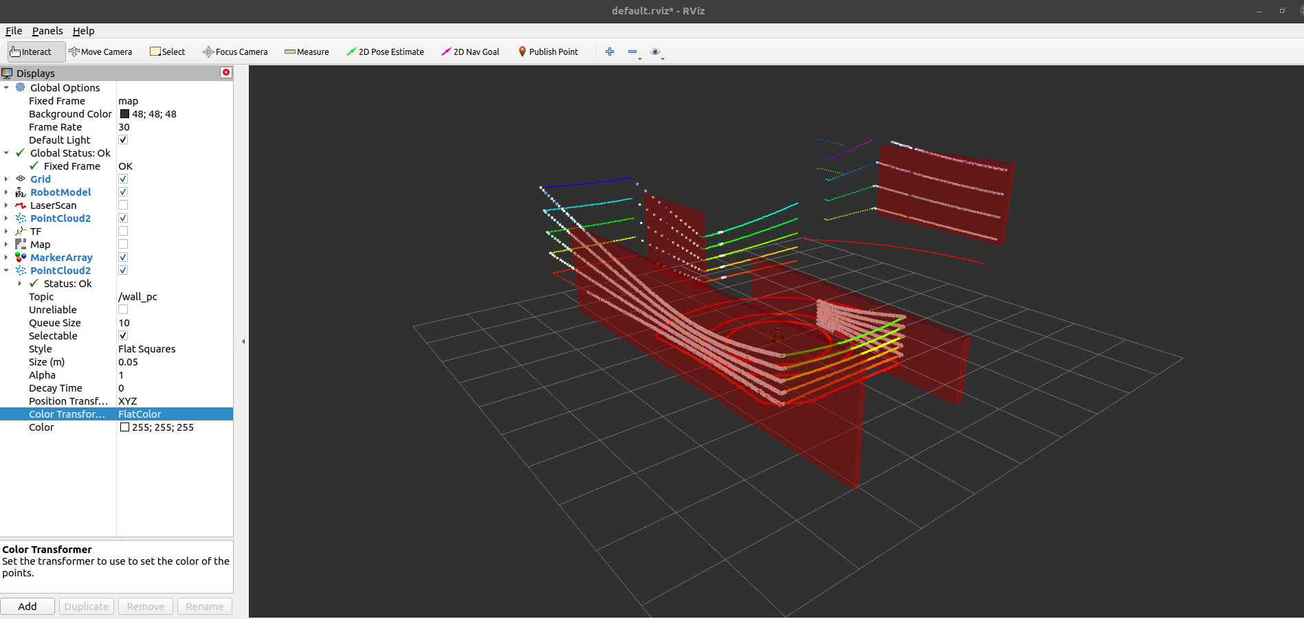
The system applies real-time vertical plane segmentation on 3D LiDAR using RANSAC to extract large structural surfaces (e.g., walls) and filter out transient objects.
Algorithm Pipeline
graph LR
    %% Main System Flow
    A[3D LiDAR<br/>Sensor] --> B(Raw Point Cloud<br/>/point_cloud)
    B --> C1

    %% Core Contribution: Vertical Plane Segmentation Node
    subgraph CoreAlgo["🔍 Core: Vertical Plane Segmentation"]
        C1[1. Voxel Grid<br/>Downsampling]
        C2[2. Plane Seg<br/>RANSAC]
        C3{3. Vertical?}
        C4[4. Accumulate<br/>Vertical Planes]
        C5[5. Project to<br/>2D LaserScan]

        C1 --> C2 --> C3
        C3 -->|Yes| C4 --> C5
        C3 -->|No| C2
    end

    C5 --> D(Filtered 2D<br/>LaserScan /scan)
    D --> E[Gmapping<br/>SLAM]
    E --> F((Clean 2D<br/>Structural Map))

    %% Styling
    classDef coreStyle fill:#ffe6f0,stroke:#ff1493,stroke-width:2px
    classDef outputStyle fill:#e6f3ff,stroke:#0066cc,stroke-width:2px
    classDef processStyle fill:#fff9e6,stroke:#ffa500,stroke-width:2px

    class C1,C2,C3,C4,C5 coreStyle
    class F outputStyle
    class A,B,D,E processStyle
From Simulation to Reality: Proving the Concept
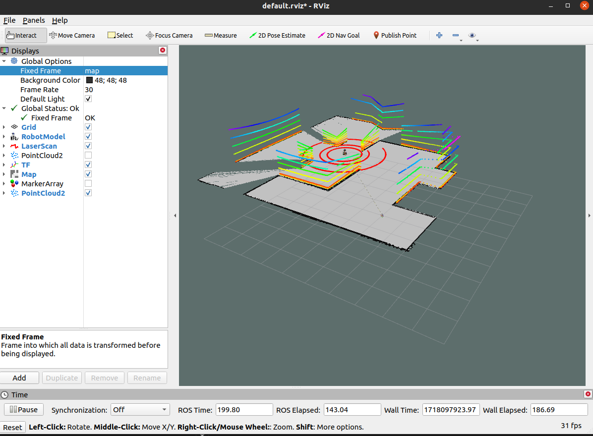
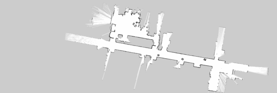
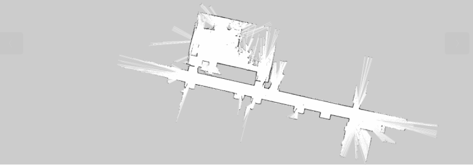
We validated the approach in Gazebo simulation and real laboratory corridors with transient obstacles, consistently producing clean structural maps in real time.
Simulation Test


Real World Experiment


After isolating structural planes, the 3D point cloud is projected into a 2D laser scan, enabling the use of mature 2D SLAM (e.g., Gmapping) to build efficient, structure-consistent maps.
Tech Stack
- Programming Languages: C++14, Python 3.6+
- Robotics Framework: ROS1 Noetic
- Point Cloud Processing: PCL (Point Cloud Library)
- SLAM Algorithm: Gmapping
- Mathematical Libraries: Eigen3
- Visualization: RViz, Matplotlib
- Simulation: Gazebo Classic
- Build System: CMake, Catkin
Results
- Processing: 10 Hz point cloud processing; 1 Hz map updates
- Resources: < 200 MB memory; < 25% CPU (Intel i7-8700K)
- Map Quality: 95% wall detection; 80% transient noise reduction; consistent maps over multiple runs
Applications
- Long-term Indoor Mapping: Creation of persistent indoor maps
- Global Path Planning: Reliable maps for indoor navigation
- Building Structure Modeling: Architectural feature extraction
- Service Robotics: Enhanced navigation for cleaning and delivery robots
Next Steps
Extend to multi-floor mapping, integrate semantic segmentation (e.g., walls vs. doors), and migrate to ROS2 for modern, scalable deployments.
Project Team
- Developer: Jiajie Zhang (zhangjj2023@shanghaitech.edu.cn)
- Advisor: Professor Sören Schwertfeger
Related Resources
- Project Slides: SLAM Project Defense
- Demo Video: System Demonstration
- Code Repository: GitHub Repository
This project makes a significant contribution to the field of lifelong SLAM, offering a practical and robust solution for creating persistent indoor maps that stand the test of time.