Campus Autonomy - Autonomous Indoor-Outdoor Delivery Vehicle
Development of an autonomous delivery vehicle capable of navigating both indoor and outdoor environments within a campus setting
Motivation
Campus logistics require a single vehicle to navigate open outdoor paths and complex indoor corridors seamlessly. The core challenges are robust scene switching, safe real-time avoidance, and reliable navigation across diverse conditions. This project targets these challenges to enable unified, end-to-end campus delivery.
Contributions
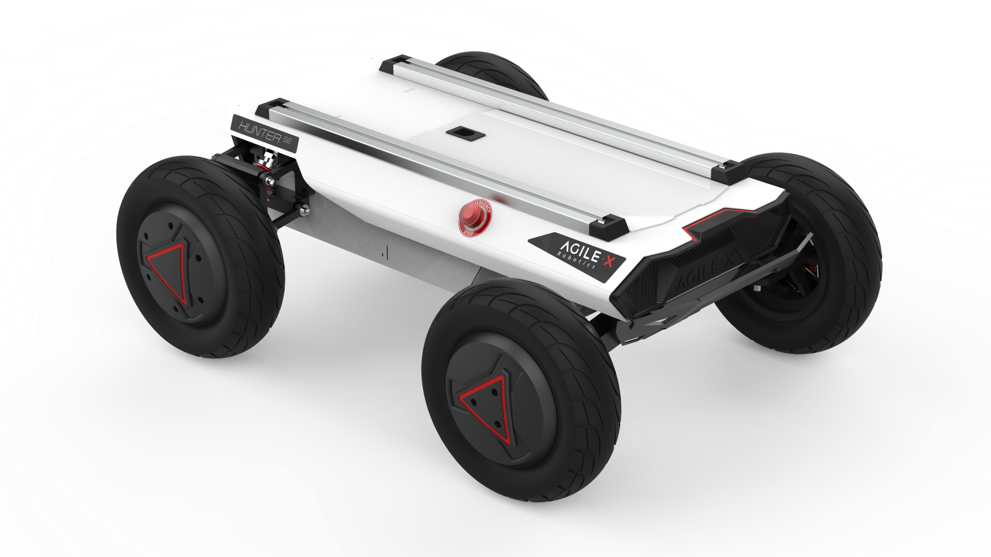
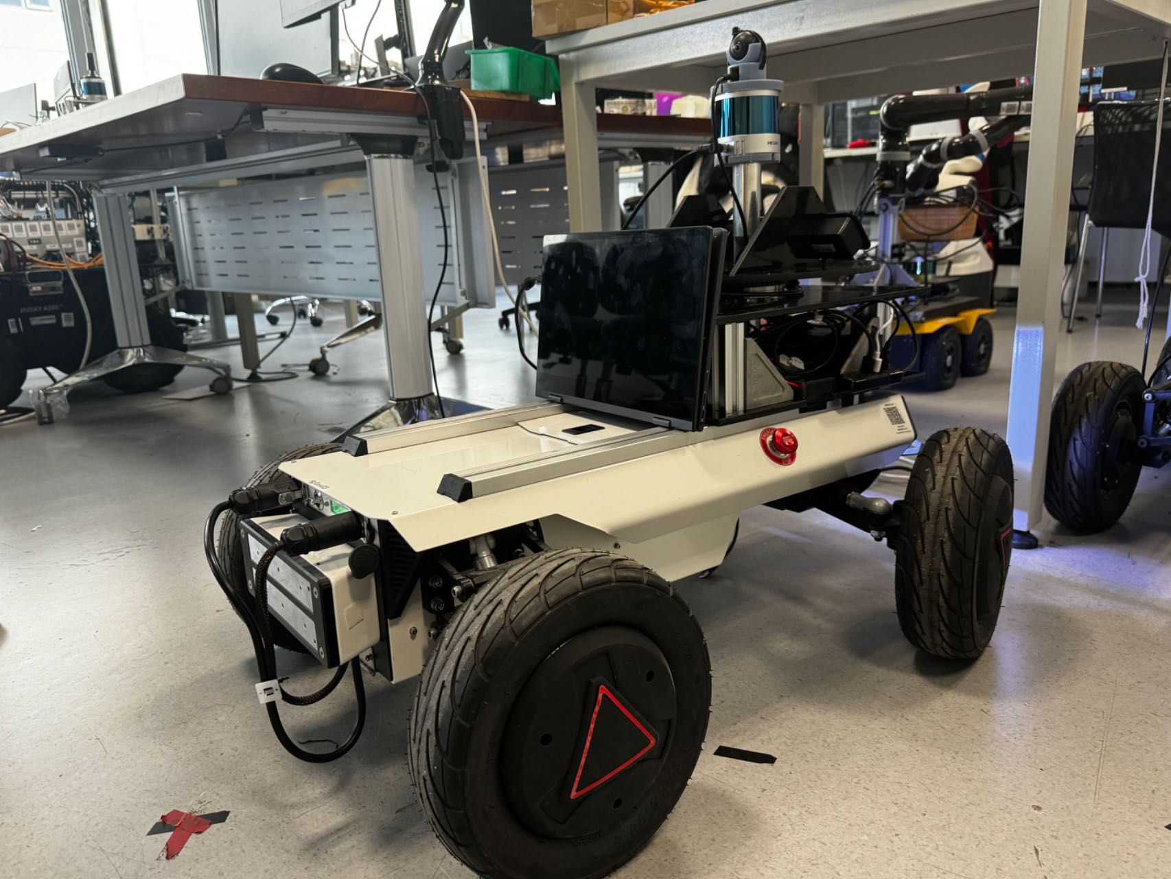
- Built a campus delivery platform on Agile X HUNTER SE with integrated Hesai PandarQT64 and panoramic vision.
- Established dual-environment navigation with GPS-aided outdoor and LiDAR-based indoor localization.
- Integrated ROS2 Nav2 with Cartographer for mapping, planning, and control.
- Demonstrated real-time dynamic obstacle avoidance and robust path re-planning.


System Overview
The platform is equipped with a rugged base, 64-line LiDAR, panoramic RGB camera, and inertial/odometry sensors to provide reliable perception across indoor/outdoor conditions.
The software stack leverages ROS2 + Nav2 for planning and control, with Google Cartographer for SLAM. Real-time perception supports dynamic obstacle avoidance and continuous re-planning for safe navigation in crowded scenes.
Key Capabilities
- Dual-environment navigation with seamless switching between GPS-aided outdoor and LiDAR-based indoor localization.
- Real-time obstacle avoidance with dynamic re-planning for safe navigation in crowded environments.
System Architecture
The system integrates sophisticated hardware and software components:
graph LR
    subgraph HW["🤖 Hardware Platform"]
        A[Hunter SE Robot<br/>Ackermann 4-Wheel]
        B[Hesai 3D LiDAR]
        C[IMU Sensor]
    end

    subgraph Perception["👁️ Perception Processing"]
        D[Point Cloud Filter<br/>PCL Filters]
        E[3D to 2D<br/>LaserScan]
        F[Sensor Fusion<br/>EKF Localization]
    end

    subgraph Mapping["🗺️ Mapping & Localization"]
        G[SLAM Mapping<br/>Cartographer]
        H[AMCL Localization]
        I[Area Graph<br/>Semantic Map]
    end

    subgraph Navigation["🧭 Navigation Planning"]
        J[Global Planning<br/>SMAC Planner]
        K[Local Control<br/>DWB Controller]
        L[Costmaps<br/>Obstacle Detection]
    end

    subgraph Control["⚡ Motion Control"]
        M[Velocity Command<br/>cmd_vel]
    end

    A --> F
    B --> D --> E
    C --> F

    E --> G
    E --> H
    E --> L

    G --> H
    H --> J
    I --> J

    L --> J
    J --> K
    L --> K

    K --> M --> A

    F -.-> Navigation

    classDef hw fill:#ffcccc,stroke:#ff0000,stroke-width:2px
    classDef perc fill:#d4edda,stroke:#28a745,stroke-width:2px
    classDef map fill:#cce5ff,stroke:#0066cc,stroke-width:2px
    classDef nav fill:#fff3cd,stroke:#ffc107,stroke-width:2px
    classDef ctrl fill:#f8d7da,stroke:#dc3545,stroke-width:2px

    class A,B,C hw
    class D,E,F perc
    class G,H,I map
    class J,K,L nav
    class M ctrl
Tech Stack
- Programming Languages: C++17, Python 3.8+
- Robotics Framework: ROS2 Humble
- Navigation: Navigation2 (Nav2) stack
- SLAM Algorithm: Google Cartographer
- Point Cloud Processing: PCL (Point Cloud Library)
- Computer Vision: OpenCV, ROS2 Image Pipeline
- Hardware Interface: ROS2 device drivers
- Simulation: Gazebo Classic
Results
- Localization Accuracy: ±0.2 m (indoor)
- Goal Reaching: 95% success rate
- Collision Safety: 100% collision-free in tests
- Throughput: 20 Hz sensor processing
- Endurance: 4+ hours continuous operation
- Payload: Up to 10 kg
Next Steps
Integrate osmAG map format with Nav2 plugins for lifelong mapping and accuracy improvements, explore multi-robot coordination for fleet operations, and strengthen robustness under varied weather and lighting conditions.
Project Team
- Lead Developer: Jiajie Zhang (zhangjj2023@shanghaitech.edu.cn)
- Co-developer: Yongqi Zhang (zhangyq12023@shanghaitech.edu.cn)
- Advisor: Professor Sören Schwertfeger
Related Resources
- Project Report: Campus Autonomy Final Report
- Demo Video: System Demonstration
- Code Repository: GitHub Repository
This project successfully demonstrates the practical application of modern autonomous navigation technologies in a real-world campus, marking a significant step forward for service robotics and autonomous delivery.